Donner Summit Canyon Docent Led Hike
Overlooking Donner Lake in Truckee CA
Posted By: Truckee Donner Land Trust
What we'll do
A trail up the canyon follows much of the old Dutch Flat/Donner Lake Wagon Road, which later served as the Lincoln Highway. Some of the historic features visible from the upper part of the trail include Native American petroglyphs, the China Wall, and the world’s first automobile underpass (1913). Look for the abandoned Turkey Truck that careened off the road in 1955, scattering 30,000 pounds of frozen turkeys down the 175’ drop and delaying Thanksgiving dinner for hungry Nevadans!
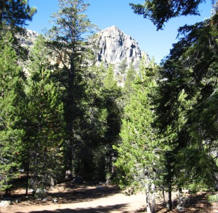
The Truckee Donner Land Trust invites you to hike with us on the trail that loosely follows the original Lincoln Highway route. The route traverses Donner Summit Creek and offers spectacular views of Donner Lake, Donner Peak, and Schallenberger Ridge as it climbs to Donner Summit. You can picnic at the Kathy Polucha Kessler Memorial Picnic Area with an amazing view of Donner Lake. You can marvel at the Native American petroglyphs as you approach the summit (Please don’t step on them!). You can watch rock climbers near China Wall. You can relax at the lower picnic area. You can count tadpoles in the Beaver Pond.
How hard is the hike?
Hiking details: Enjoy a docent-led, 6+ round-trip hike with a 1,000’ elevation gain; moderately strenuous due to uneven terrain and moderate to steep ascents.
Can I bring my dog?
No. Pets will not be allowed on any of the group hikes. We kindly ask that you please leave your pets at home. Your canine companion is welcome at every Land Trust property that is currently open to the public. Please visit tdlandtrust.org for recommendations.